
920 NM Flying – 3 days/nights Music/Dancing – 93 miles Mountain Biking
We’ve been flying to Quincy CA – Gansner Field (2O1) since the early 1980s and it never fails to be a magical place to visit. Located in Plumas County and the Sierras it is a small logging town that has a lot to offer. We first flew to Quincy from our home in Klamath Falls Oregon in our Grumman Cheetah.
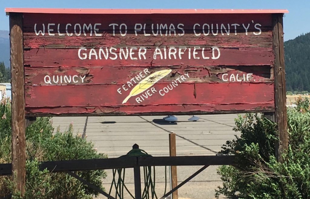
Quincy – Gansner Field
This time we were visiting Quincy to attend the awesome High Sierra Music Festival (HMSF) for the second time from our home in San Diego CA (Montgomery KMYF) in our Cirrus SR22. Not to be content with just attended the festival we also brought our mountain bikes to explore the mountains and to get around the town and festival!
The flight was smooth under clear skies, with a few knots of tailwind, it was a nonstop flight of 2:50, over scenic terrain and vistas. Our flight followed the western slope of the Sierras, with only one deviation to stay clear of the restricted airspace near Edwards Air Force Base.
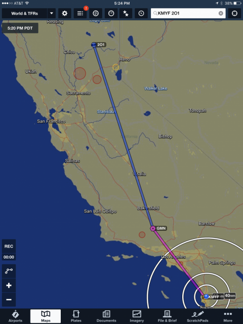
Our flight to Quincy – Red Circles represent forest fire activity and Temporary Flight Restrictions (TFR) for firefighting.
Since this is high fire season we did see a fire that had just started west of Auburn CA. In the 1980s I flew for Weyerhaeuser during the summer monitoring their forests for fires. I remember one particular flight in northern California after a lightning storm in 2008 that spawned more fires than I could count.
On the way up to Quincy we spotted a few airports for future visits, Blue Canyon (KBLU) and Columbia (O22) , both look like great hiking and biking spots.
Quincy California
We always like to survey the area before we land. It was great to fly over the valley, circling the festival venue at the Plumas County Fairgrounds, our favorite swimming hole on Spanish Creek (more on that later), the town and of course the airport. We were arriving on the first day, so it was pretty quiet in town and the airport. The airport is in a narrow valley, which makes some of the approaches, and departures, a challenge. To the west is a even narrower valley between the hills that requires a dogleg to the right during the climb, so proper planning is important. Immediately to the north of the runway is large hill. We circled north over Spanish Creek, then entered a right base and then final to Runway 25 (length 4100 feet). The runway is a bit rough, however it is quite usable and they have a great price on self-serve fuel! Bring tie-downs since the current ramp area doesn’t have them. Plumas County is also engaged in a program to upgrade the airport, so you may see improvements on your visits.
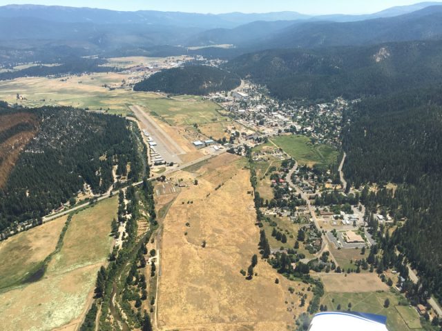
Quincy Gansner Field East View Runway 7. Quincy is to the right of the airport and the Fairgrounds east over the small hill.
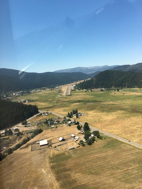
Quincy Gansner Field 2O1 – On Final for Runway 25 – The road in the foreground is Quincy Junction which leads to the Spanish Creek Trailhead
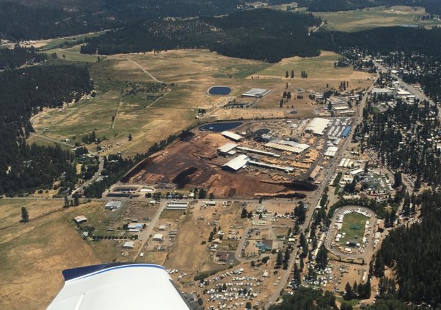
High Sierra Music Festival Aerial – at the Fairgrounds just to the right of the lumber mill.
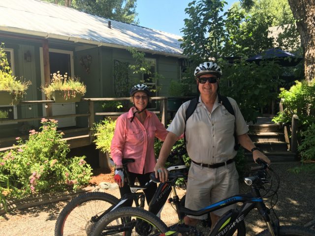
We were staying at Ada’s Place, a great collection of cottages in Quincy. Mike Nellor of Ada’s Place, greeted us at the airport to help with our luggage while we rode the bikes to the cottages. Mike is a veteran with some great stories, and his wife Valerie is also a very gracious host. We rode our bikes the mile to our cottage with Mike ahead in his truck. Ada’s Place is the perfect place to explore Quincy all year-round whether you are biking, hiking, or just exploring the area.
At our cottage for the week – Ada’s Place
Our cottage was amazing, and cute! Nestled among beautiful landscaping, and beautiful inside, it provided all of the comforts away from home. The last time we attended HSMF we camped in our tent with our son and his girlfriend in the livestock pens at the Fairgrounds. We had to push the cow patties out of the way and navigate the livestock chute to the bathrooms!! While a great experience, it is one of those things we didn’t need to do again 🙂
The town of Quincy is one of the friendliest places to visit. Located approximately 80 miles Northwest from Reno it is in a very scenic area with year-round activities. The Plumas County Museum, adjacent to the courthouse, displays an interesting history of the area including it’s rich mining history. The Natural Food Store (Co-op) is on the main street, as well as a Safeway and other places to stock up on supplies. On Thursdays during the summer there is a nice Farmer’s Market just by Ada’s, at the Dame Shirley Plaza by the courthouse, that features local produce from the region, crafts, and music.
One of the unique aspects of the area, are ‘barn quilts’. There is actually a Barn Quilt Trail in Plumas County with many of the art pieces displayed in Quincy, on you guessed it – barns! We had fun riding out bikes around the area and discovering this unique public display of art.
The town is quiet at night, so just make sure you scope out the restaurants, etc. if you plan to eat late since their hours may vary. We had great food, at very reasonable prices, throughout the town. We had wonderful salads and sandwiches at Pangea and the West End Theatre, which is also home ot many performing arts events. The local residents were also very helpful in guiding us to great places to eat, bike, and visit.
High Sierra at Last!!
There is something magical about music festivals, and the High Sierra Music Festival matches our vibe, funkiness, and eclectic music tastes ! Smaller at 8-10,000 attendees, than some of the other multi-day festivals, it offers a great chance to see a wide variety of artists (music, art, performance), see old friends and meet a lot of new ones!
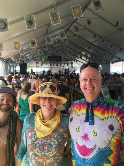
Jane, Rich and a friend at the Vaudeville Tent. My shirt is from our last visit to High Sierra.
With music all day and night, available from morning until 3 or 4 a.m. we had ample opportunity to watch some great artists. HSMF has a number of official venues: Vaudeville Tent, Big Meadows, Grandstand, Music Hall and others, as well as a number of ad-hoc music areas that offer spontaneous jams. With music continuously playing, if a certain genre doesn’t interest you, simply find another! With such groups as Ben Harper, Tauk, Turquaz, The California Honeydrops, Liz Vice and 20+ others, the difficult decision is where to go 🙂 Most of the time, we would listen to artists for a while, then venture to another venue to catch another great performance at the same time.
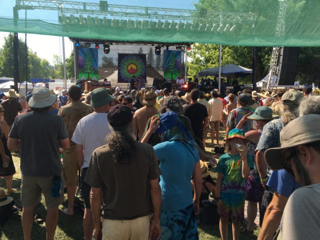
High Sierra – Big Meadow venue
It was just wonderful to dance to music, some familiar and most not, with so many very happy people. The energy was so positive, that it still puts a smile on my face! Seeing families attend, and young parents hauling their kids in wagons around the grounds and camp areas was great. While we didn’t camp this time, the energy and community in the campgrounds was palpable- with everyone helping others. It almost enticed us to try camping again !
Late Night
For those inclined to listen to music until 4 a.m., High Sierra also offers late performances starting at Midnight. We listened to The Main Squeeze on Friday night. Many of the musicians play at other times, however these performances are usually in a smaller venue which is nice as long as you can stay up very late, which can be helped by copious consumption of Red Bull!
Performers and Parade
The HSMF abounds with various performances to watch, whether you want to watch or participate! From art classes, to tie-dye instruction, to how to Jam, or yoga. One of our favorites is the Parade. While there are ‘official’ (if there is such as word at HSMF) performers, it is open to anyone who would like to hold a puppet, flag, or whatever. One of the favorite groups are the men and women of Samba Stilt Circus!! I don’t like ladders so I am always amazed with their performance. It is just one of the high-energy aspects of High Sierra!
High Sierra 2016 Parade from Personal Wings on Vimeo.
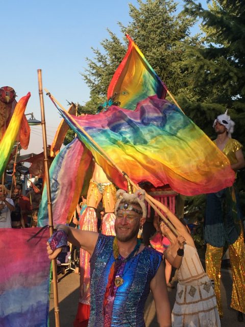
High Sierra Parade – Flag Procession
Mountain Biking
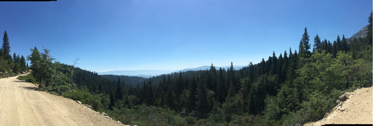
Plumas County is a great place to bike, and now is one of our favorites ! Okay, I love just about any place I visit but this is really is great :). On Friday morning after a late night of music, we thought we would warm up with a 20 mile ride up the mountains to Snake Lake and back.
Snake Lake
The road to Bucks Lake follows a beautiful canyon up to, you guessed it – Bucks Lake! Mike at Ada’s Place recommended visiting Snake Lake on the way, a place he likes to hike in the early morning. After our first late night of music, it seemed like a good warm up ride, only 10 miles away up the canyon.
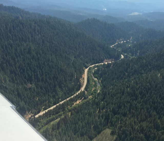
Winding road to Bucks Lake – Spanish Creek is on the right of the road. Aerial view from our SR22.
Jane leading the way to Snake Lake
Even the ride up the road towards the lakes was beautiful, with us stopping along the way to enjoy the scenery.

On the way to Snake Lake – Spanish Creek
Plumas County was one of the first locations of the California Gold Rush. Some of the towns are no longer present, however you can still find some old mines and active mining claims in the area. This sign, along the road, describes a 20 mile ditch that was manually dug to bring water for the mining.
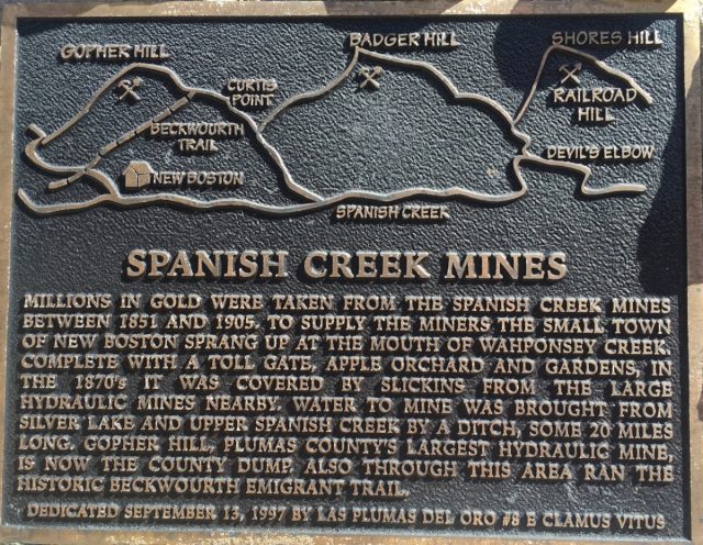
Spanish Creek Mines Interpretive Sign.
We were riding our Haibike e-assist mountain bikes from the Bicycle Warehouse in San Diego. While the bikes still require a lot of pedaling, it is amazing how just some assistance from the 400W motor helps with the climbs! While we have always loved to bike, these pedal-assisted mountain bikes have increased our riding range by many factors. In the first two months, I’ve biked nearly 400 miles on trails and roads.
Six miles up the Bucks Lake Road from Quincy you turn right at the bridge. It is important to know where to turn because there are no signs! Thanks to Mike Neller we knew where to turn. Three miles up on pavement and gravel you arrive at the first campground at Snake Lake. We use various apps for navigation, and still haven’t found the perfect one for biking. One that comes in handy for offline maps (important when you don’t have cell service) is Offmaps which utilizes open source maps. I’ve used these maps in Haiti when helping after their earthquake in 2010 and nothing else was available. It isn’t perfect, but it can help you from getting too lost! I’ll write about other options in a separate blog.
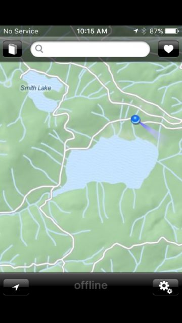
Offmaps – Snake and Smith Lake. Different zoom levels provide road and trail details
The lake is being overcome by non-native plants, which is regrettable since depletes the nutrients for other life, but it is still a nice place to visit, ride your horse, and hang out in cooler temperatures. The bike ride is a moderate climb, especially if you venture around the lake or go up to Smith Lake, a smaller lake nearby that has water seasonally. We ran into people camping that were extremely helpful, pointing out other places to ride and hike.
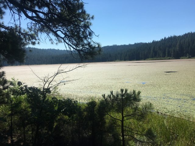
Snake Lake
Spanish Creek Trailhead
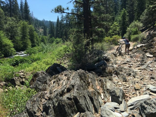
On Saturday after a great day and night of music from TAUK, Turkuaz, Main Squeeze and others, we headed to the many trails along Spanish Creek, also near a fun swimming hole! Riding just east of the airport along Quincy Junction Rd. it is an easy ride up to the trailhead. This is one of the trailheads for the South Park Non-Motorized Trail System, basically where you want to ride!
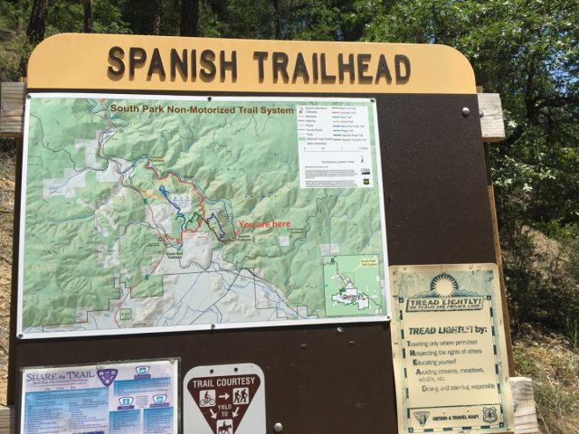
Spanish Creek Trailhead – South Park Trail System
The map is clearly labeled, if you actually read it 🙂 I led the way to the right, thinking it was the way to the easier route. Quickly we found that not to be the case.
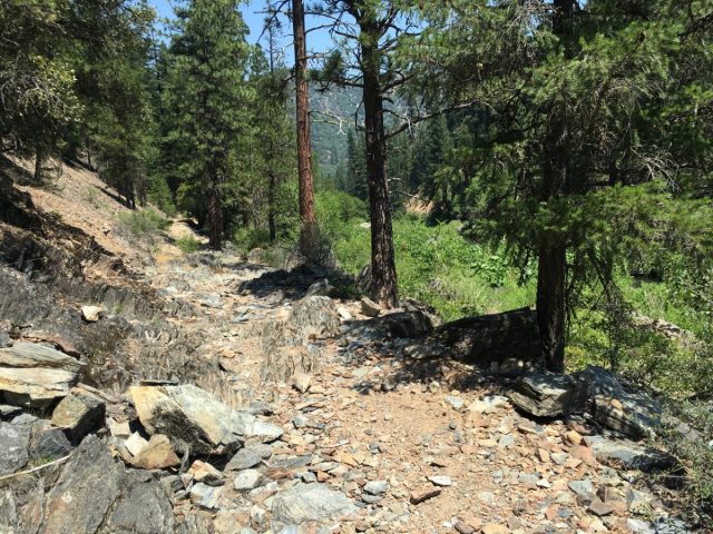
Maybe this isn’t the right trail….
We decided to continue, because you don’t know what is around the corner until you try it. When you have to navigate over large obstacles, you realize that the e-bikes can be a bit ponderous to pick up and move. I would have helped Jane, except someone had to take the photograph!
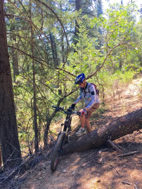
Just a few obstacles along the way
Of course, around the corner were some beautiful sites of Spanish Creek, small waterfalls, and vegetation.
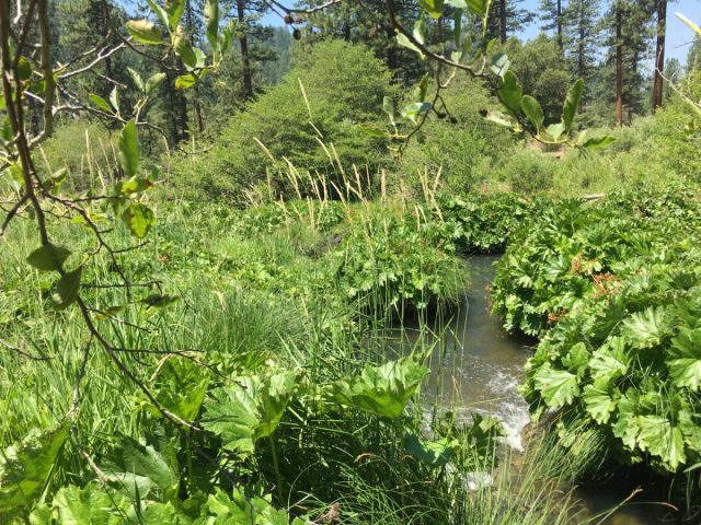
Spanish Creek – flowing water through small waterfalls
The trail faded more and more, until we couldn’t find it any more and it was time to turn around, of course we had to go through a few obstacles the other way.
A more technical portion of the Wrong Way Trail
Just to the right of the Trailhead is a road that leads up to the Oakland Recreation Camp, and a very nice access road that progresses up the canyon on the east side of the creek. A helpful ranger pointed out some swimming spots along the creek that offered a quiet, and private, access to the creek about a mile from the camp.
Just before reaching the Trailhead is a more accessible, and public, swimming spot that is great when it is hot. Sometimes the water can be quite chilly, but this day it was probably in the upper 70s. I decided to take my shoes off and just wade in a few feet. Why should I change into a swim suit when all I was going to do was cool off a bit. The water was great, so I went a bit deeper, taking out my iPhone to take photos. Before I could say ‘High Sierra’ I was totally submerged, clothes, wallet, and backpack. I handed my phone to someone standing on the edge and emerged a bit wet but a lot cooler from the ride!
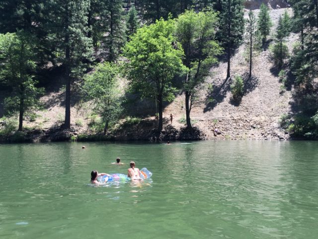
Spanish Creek Swimming Hole
We ventured back to the Festival for the evening and more music, and thought about another ride before we would leave for home on Sunday. On Saturday night we listened to Anders Osborne, Lettuce, Ben Harper and the Innocent Criminals. What a great way to listen, and dance, to a variety of music with great weather and friends.
Of course it is always fun to ride a night, and we took a short cut along a fun trail back to the cottage at midnight.
Bucks Lake Road – Detour to Silver Lake
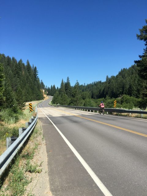
We were now psyched to bike to a higher elevation before leaving for San Diego. We decided to try Bucks Lake, approximately 17 miles from Quincy up the same road that led us to Snake Lake. With a full charge on our Haibikes we were off. The road past the Snake Lake turnoff is windy and fun, with a number of narrow sections and all of the motorists were courteous. One of the nice features of the e-bikes is the speed you can maintain along the roads. While the top speed for the assist on our bikes was 20mph, it was enough to help us go faster.
Along the way to Bucks Lake you enter Meadow Valley, a small town with a great country store, and beautiful views. We had gained about 1,000 feet in elevation.
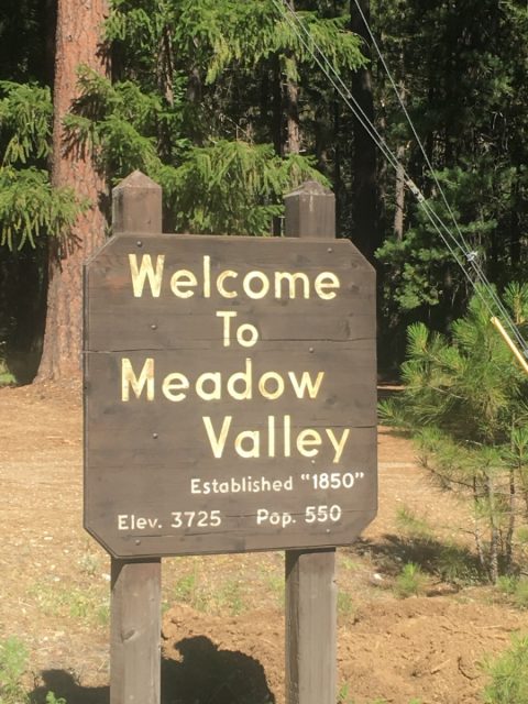
Meadow Valley Village
Just past Meadow Valley, we came across a turnoff with a sign to Silver Lake. Jane thought it sounded like a nice place, and since my navigation has led us down a difficult path on the last ride, we decided to take her suggestion.
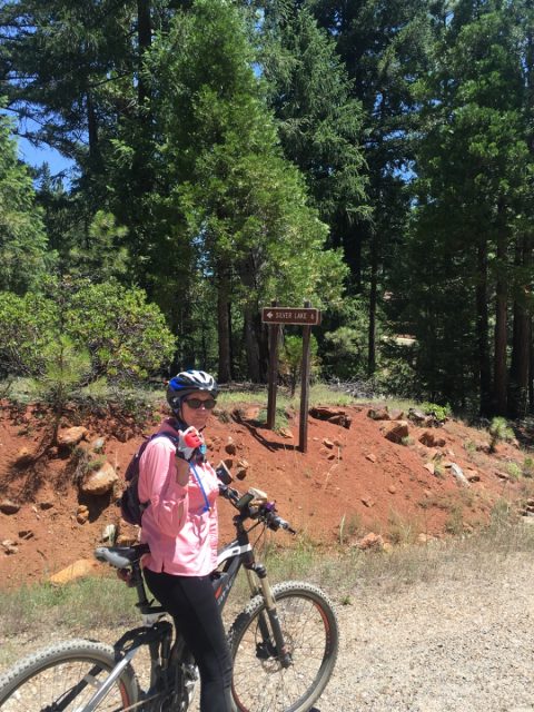
Jane leading the way to Silver Lake
The initial approach to Silver Lake looked very nice. The roadway was smooth and there was no traffic.
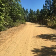
Starting the ride up to Silver Lake
As we rode around one of the corners, and the grade increased on the road, we saw Spanish Peak in the distance and thought we were glad we weren’t going up that far.
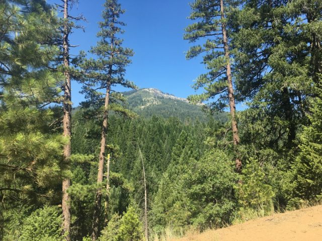
Starting the ride up to Silver Lake
With the climb becoming steeper it was great to stop and take some photographs of the views.
Vista on the road to Silver Lake
We kept out checking our odometer, and battery charge on the bikes. While we knew we could always rely only on pedaling back to Quincy, there were some steep climbs still ahead of us. With each turn around a corner we were getting either closer, or more lost, and each view of Spanish Peak was getting closer. We finally deduced that Silver Lake was probably high up on the peak.
Jane and I traded bikes on the way up so she could try my dropper seatpost and my bike had a higher charge level. The last segment was probably the steepest, later we learned that our steeped grade was 16% with many grades above 8% on the way up.
We finally made it to Silver Lake and it was worth the effort! It was 16 miles from our cottage, 1 hour and 35 minutes, and an elevation gain of 2400 feet.
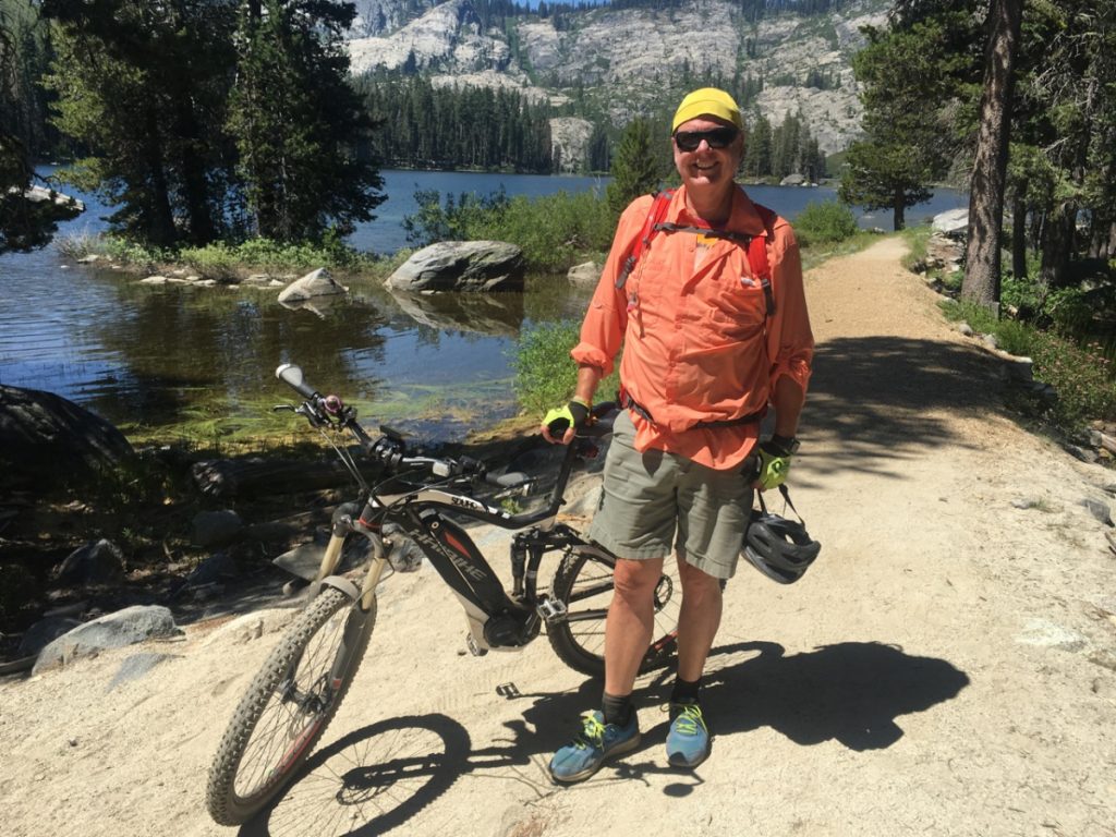
Rich at Silver Lake
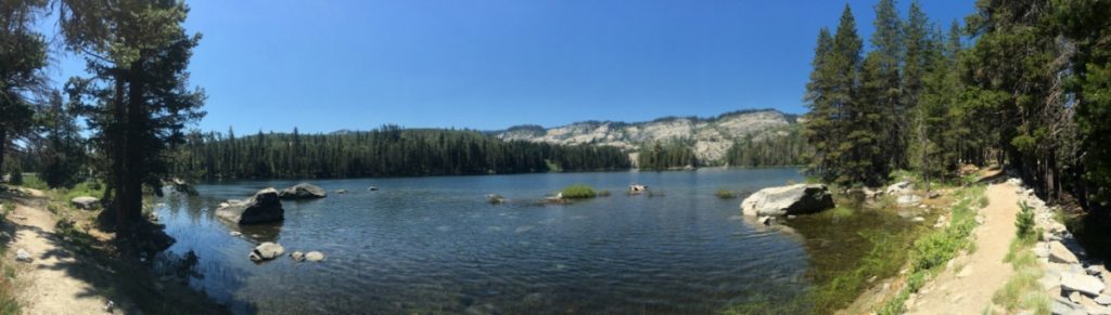
Silver Lake Panorama
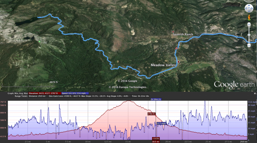
Quincy to Silver Lake Route and Profile
We only stayed a few minutes up at the lake, however we found some great hiking trails for another time. We met some local folks from Quincy who were extremely helpful, and amazed we rode all the way up from Quincy. They typically don’t see older bikers this far up the mountain!
The way back was obviously faster! At Silver Lake our e-bikes registered 16 miles range on High, 19 on Standard, and a bit higher on the 2 lower settings. We knew that we wouldn’t need much help on the way back to Quincy, however there were some steep climbs on the return. The range is approximate and is determined by how much you use the assist. We stopped at Meadow Valley for some water for the hydration packs. Note to self: you can never have enough water 🙂 By the time we arrived back at Quincy we had 6 miles left on High and 9 on Standard. Second note to self: Bring a charger when biking in the mountains!
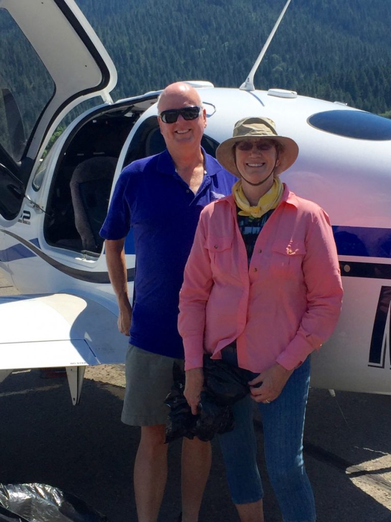
Heading Back to San Diego
After a great lunch at the West End Theatre, and saying good bye to our friends, we headed back to the airport. We also wanted to take some aerial photographs of where we had biked on the weekend.
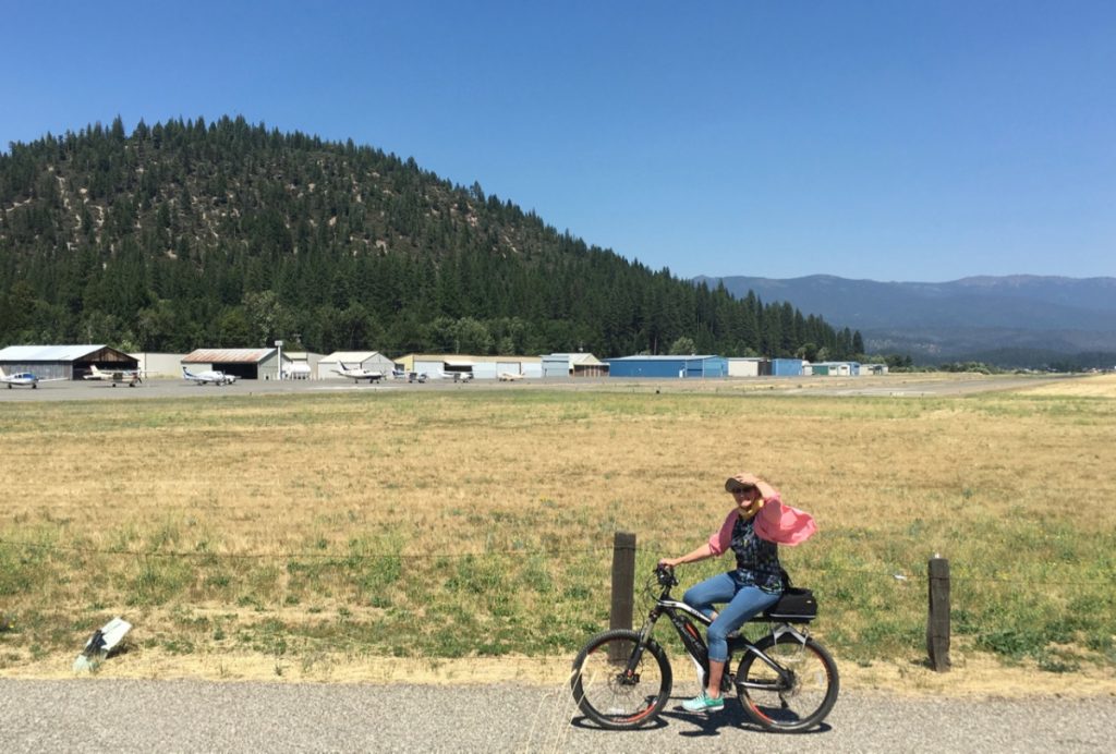
Jane Biking to the airport
Rich and Jane at DJ at Quincy
It was a great way to spend several days, flying to Northern California, mountain biking, spending time with friends, and enjoying music.
Aerial Photos of Our Rides
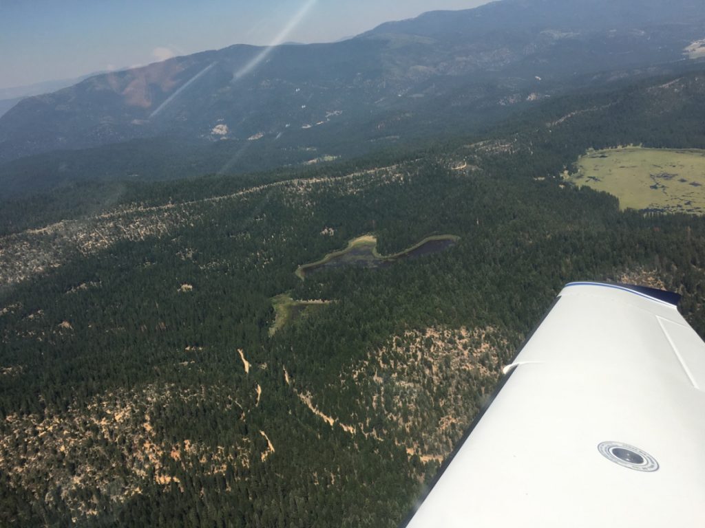
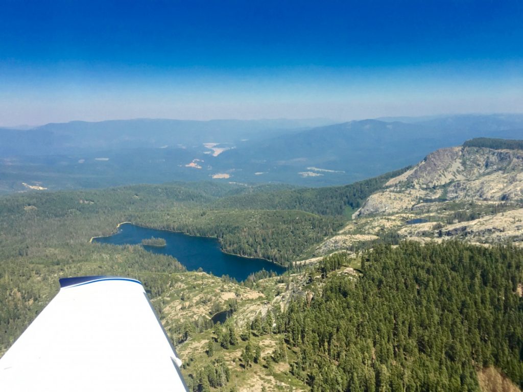
Smith and Snake Lakes
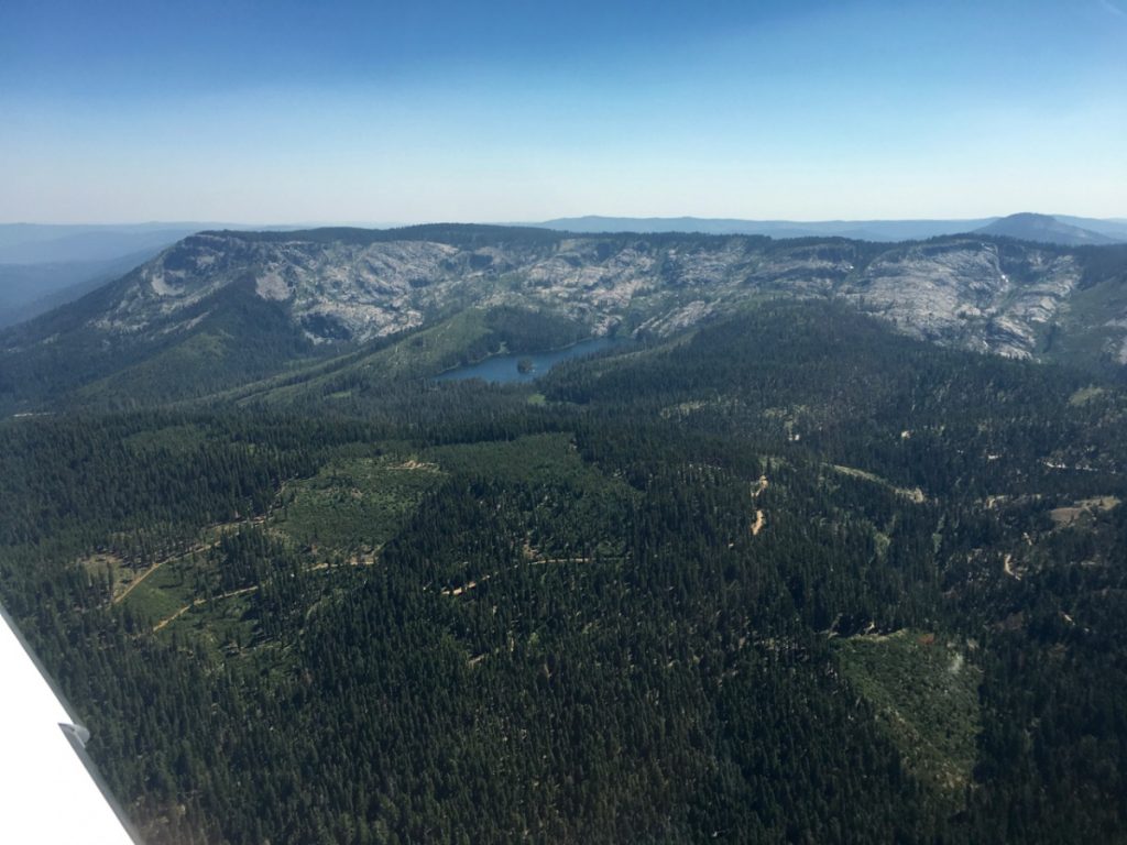
Silver Lake from our Cirrus
Silver Lake at Spanish Peak – Quincy in Far Background
This is great! Thanks so much!
You’re welcome. A nice place to fly and visit when you guys are up north.